Longshaw Estate Guidestoop

Region:
Red Wheel Site:
Transport Mode(s):
Address:
Postcode:
Visitor Centre:
Website:
Visit website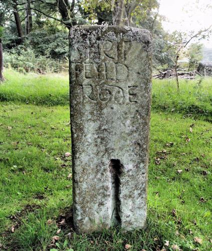
By the end of the 17th Century, the condition of the roads was worse than 100 years earlier. This was partly because of the damage to infrastructure during the Civil War, and partly because of increased usage, resulting from the move to a more regionally based economy. The problem was exacerbated by the French War (1688-1713) which curtailed coastal transport and put more pressure on inland roads.
As a response to pressure from the merchant classes, the Government passed an Act in 1697 (William III 8 and 9, Chapter 16) to improve road conditions by requiring parishes to maintain their roads. Also for the first time Justices of the Peace (JPs) were instructed to erect guideposts or guidestoops (from the Scandinavian word for stone) in moorland areas.
This was particularly important because roads and tracks were ill defined and no practical maps were available until the 1760's. As a result most travel over moorland areas took place only during the summer months, and goods were only carried between May and October. Some personal travel took place in winter and there were several occasions of travellers losing their way in bad weather and dying out on the moor. Guidestoops were therefore in effect the first road signs.
Lancashire JPs responded quickly, although there are no known surviving Lancashire guidestoops. West Riding magistrates followed in 1700 and Yorkshire examples survive. It was 1709 before Derbyshire JPs gave instructions.
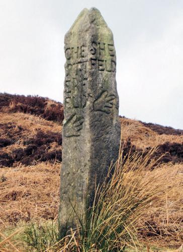
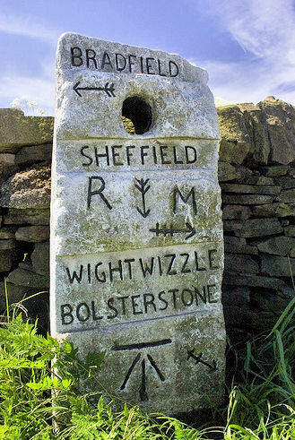
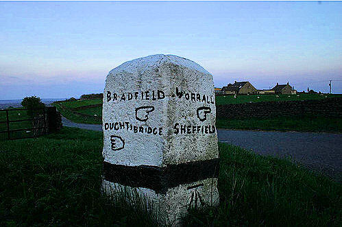
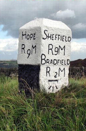
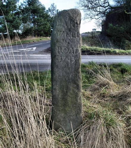
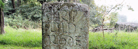
A typical guidestoop is about 2m high and resembles a farm gatepost with faces about 30cm wide. They were erected at isolated cross roads or junctions, and were inscribed usually on all four faces with the name of the nearest settlement of any size.
Some were also inscribed with a hand pointing in the required direction, but the usual rule was to face the stoop and turn right to reach the settlement inscribed on that face. The spelling of place names is often phonetic, with Alfreton, for example, being rendered as Offerton, Allforton and Alfarton. Some West Riding stoops also gave the mileage to the settlement, but this was not done in Derbyshire. Many of the Derbyshire stoops are inscribed with the date and one can also sometimes find the name of the person responsible for the erection of the stoop.
About 40 stoops can be found in the white and the dark peak of Derbyshire. Some were removed during the Second World War to avoid giving information to enemy invaders, and some were replaced, although occasionally on the wrong orientation.
Shown in the images are various Derbyshire guidestoops - National Trust Longshaw Estate, Beeley Moor, Cornerston Farm, Wightwizzle, Bradfield and Hope.
By road: On B6521, off A6187 and A625.
Benford, Mervyn, Milestones, Shire, ISBN 0747805261 (2002)
Haines, Carol, Marking The Miles - A History of English Milestones, Haines, ISBN 0-9538885-0-9 (2000)
Hey, David, Packmen, Carriers and Packhorse Roads; Trade and Communications in North Derbyshire and South Yorkshire, Leicester University Press ISBN 0 7185119 2 1 (1980)
Smith, Howard, Guide Stoops of The Dark Peak, ISBN 0952154137 (2002)
Smith, Howard, The Guidestoops of Derbyshire, Rotherham Department of Libraries, Museums and Arts ISBN 0 9521541 1 0
Wright, Geoffery N, Turnpike Roads, Shire, ISBN 0-7478-0155-X
Long Distance Walkers Association - Eleven Guide Stoops of Bradfield
Moorland Guidestones and Markstones
National Trust - Longshaw Estate, trackways, turnpikes and guidestoops
Sites of Meaning - Marker Stones for The Millenium