St. Ives Bridge

Region:
Red Wheel Site:
Transport Mode(s):
Address:
Postcode:
Visitor Centre:
Website:
Visit website


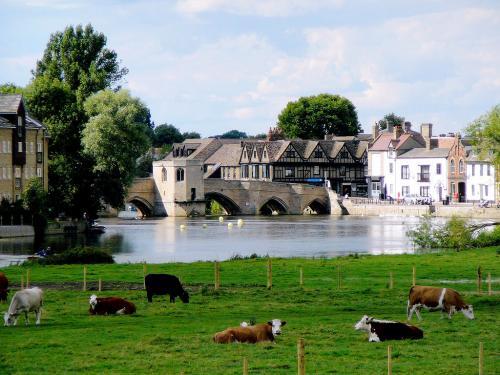
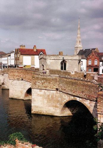
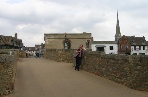
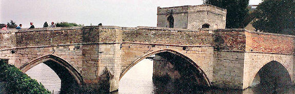
The St Ives settlement was developed by the monks of Ramsey Abbey who built the town's first bridge, a wooden structure, in 1107. In 1414 it was decided to replace this bridge with a stone arch bridge, which was completed in 1425, the chapel being added the following year.
During the English Civil War the bridge was partially blown up by the troops of Oliver Cromwell to prevent King Charles I's troops approaching London from the Royalist base in Lincolnshire. During the war, and for some period afterwards, the gap was covered with a drawbridge. When the bridge was rebuilt in 1716 the shape of the new arches at the southern end was in accordance with the style of the period, leaving the bridge with two rounded arches on its South side and two Gothic arches on the North. The bridge is only one carriage wide and in good order and is a particularly attractive sight in a charming small town.
The chapel was restored in 1930, after periods of use as a toll house, inn and as a private residence. By 1736 it was being used as accommodation, and in that year two extra floors were added. These remained until the early 20th century until removed as part of the restoration work and, as a result, the roof is modern. An unusual feature is the crypt which sits two metres above water level.
The bridge and the chapel are now Grade I Listed Buildings and a Scheduled Ancient Monument.
South of the bridge, the London Road proceeded across a swampy area on a causeway with piecemeal bridges built by various benefactors, from time to time and as the currents of the water shifted. In 1755 it became the responsibility of the Bury to Stratton Turnpike Trust. The condition was still unsatisfactory when the Trust was renewed by an Act of 1818. At this point firm action was taken and the causeway was totally rebuilt and opened in 1822. With an astonishing 55 arches, it is the longest road causeway - as well as having the largest number of brick arches - in the country.
By road: Off A1096, the bridge is pedestrianised at the end of Bridge Street in the town centre. The New Bridges on the old London Road are a cul de sac and best approached from the old bridge. They are also visible from the by pass.
By rail: The bridge is approximately 1 km from St Ives Station.
Addison, Sir William. The Old Roads of England ISBN 0 7134 1714 5 (1980)
Albert, W. The Turnpike Road System in England 1663- 1840. Camb. Univ. Press. ISBN O 5210 3391 8 (1972)
Burn Murdoch, Bob, St Ives Bridge and Chapel (2001)
Flanagan, Bridget, The New Bridges (2005)
Harrison, David. The Bridges of Medieval England. Oxford. ISBN 978-0-19-922685-6 (2004)
Hindle, P. Roads and Tracks for Historians. ISBN 1 86077 182 3 (2001)
Hindley, G. History of the Roads. Peter Davies. ISBN 0 8065 0290 8 (1971)
Jackson, Gibbard. From Track to Highway. (1935)
Jervoise, E. Ancient Bridges of England. Architectural Press. (1932)
Pevsner, N., Buildings of England: Beds and Hunts (1964)
Sheldon, G. From Trackway to Turnpike. Oxfd. Univ. Press. (1928)
Taylor, C. Roads and Tracks of Britain. ISBN 0 460 04329 3 (1979)
Forgotten Relics - Listed Bridges and Viaducts
The Chapel on The Bridge - Images
Waterscape - St Ives Town Bridge