
Scotland Street Tunnel, Edinburgh

1847-1868
Built to link Waverley with the Fife ferries, this tunnel was so steep that it required trains to be cable-hauled by a stationary steam engine
Region:
Red Wheel Site:
Transport Mode(s):
Address:
Scotland Street Tunnel, Canonmills, Edinburgh
Postcode:
Visitor Centre:
Website:
Visit website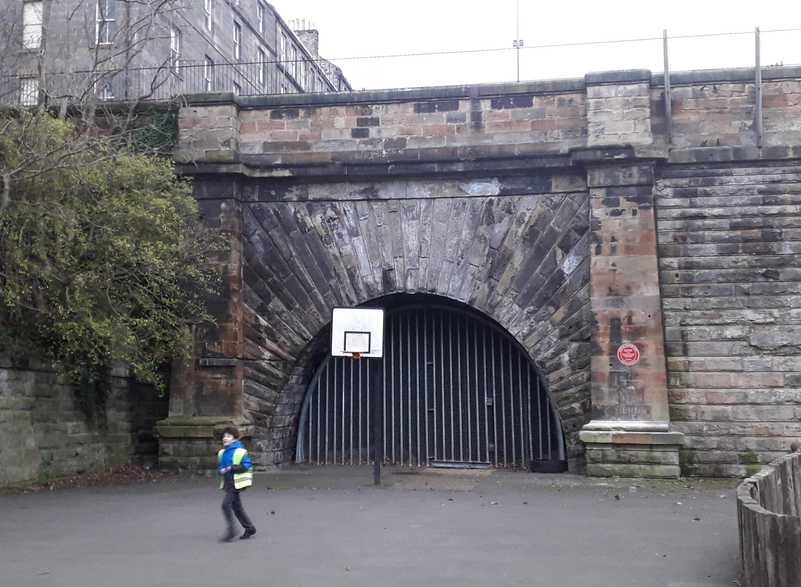
The Edinburgh, Leith and Newhaven Railway, which later became the Edinburgh, Leith and Granton Railway, carried passengers and freight between Edinburgh city centre and the northern ports. It was Edinburgh's second railway, after the Edinburgh and Dalkeith Railway. All of the original route has been dismantled, but part of one of its later connections remains in use for freight.
The line was originally horse-drawn, and ran from Canonmills (later Scotland Street) to Newhaven (later Trinity), with services beginning on 31 August 1842. On 19 February 1846 the line was extended into the Duke of Buccleuch's recently built harbour at Granton (completed 1838), and became the Edinburgh, Leith and Granton Railway.
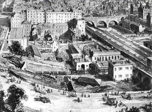
A branch to Leith was opened on 10 May 1846; Citadel station in Leith (formerly North Leith) is one of the remaining structures from the original line. An intermediate station was provided at Bonnington; Junction Road opened in 1869. It was further extended to its city centre terminus at Canal Street (later absorbed into Waverley station) in 1847, by a 1000 yard tunnel which carried the line from Canal Street under Edinburgh's New Town with a peak gradient of 1 in 27.
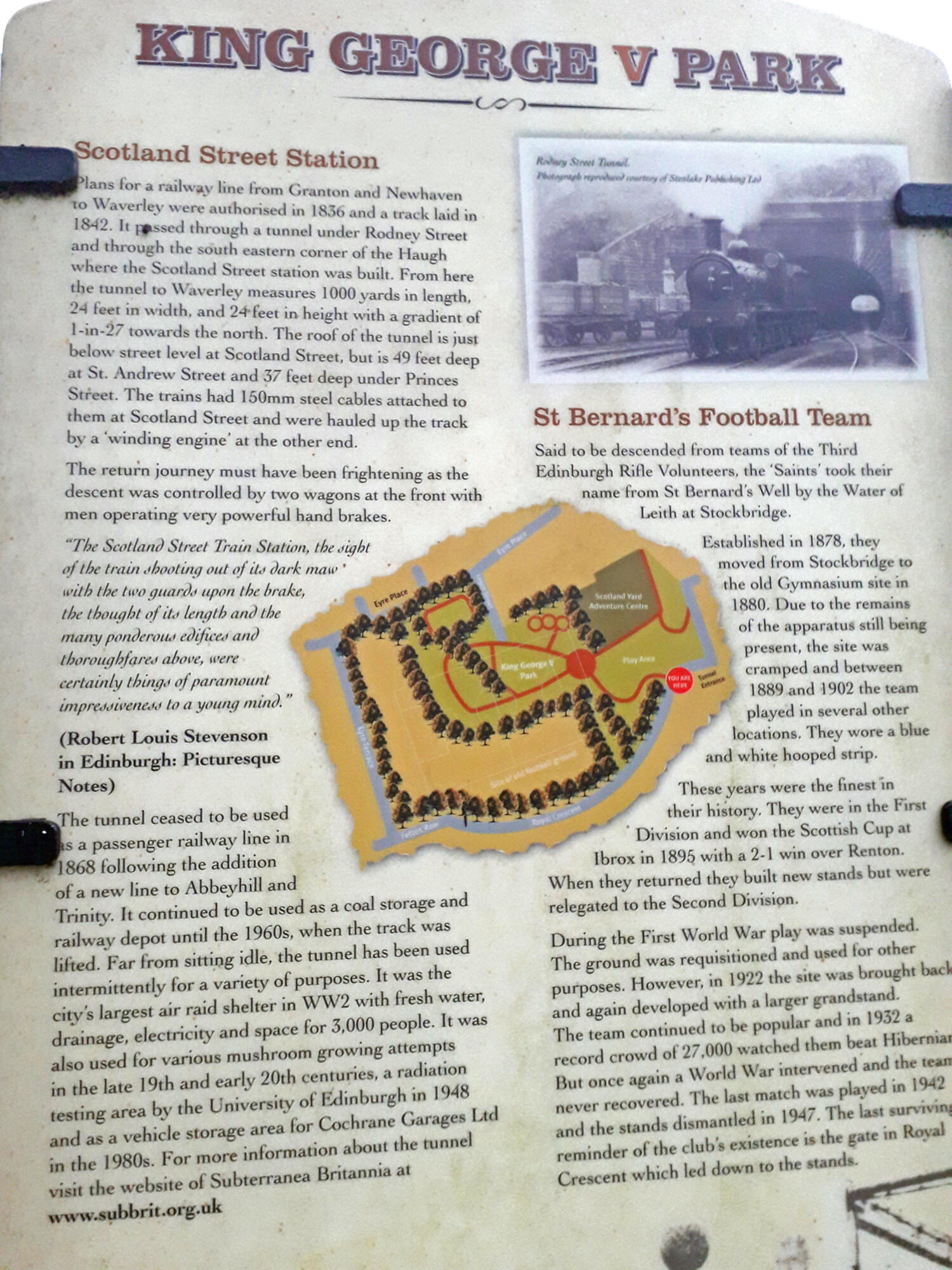
It was operated by a stationary engine and hauled trains up the slope with an endless rope. The tunnel was designed by Thomas Grainger, who had to overcome the shifting sand under the New Town and the concerned property owners above ground. The tunnel is just below street level at Scotland Street, but is 49 feet below St. Andrew Street and 37 feet below Princes Street. At the same time as the tunnel was opened, horse power was abandoned on the rest of the network in favour of steam locomotives.
This short passage by Robert Louis Stevenson provides a captivating glimpse back to the days when the tunnel was in operation: “The Scotland Street Train Station, The sight of the train shooting out of its dark maw with the two guards upon the brake, the thought of its length and the many ponderous edifices and thoroughfares above, were certainly things of paramount impressiveness to a young mind.”
At Granton, the world's first train ferry took goods wagons by boat to Burntisland Station (see entry) in Fife. The service commenced on 3 February 1850. Thomas Bouch designed the ferry slip. From Burntisland, Edinburgh and Northern Railway services connected to Perth and Tayport (ferry to Broughty Ferry, for Dundee).
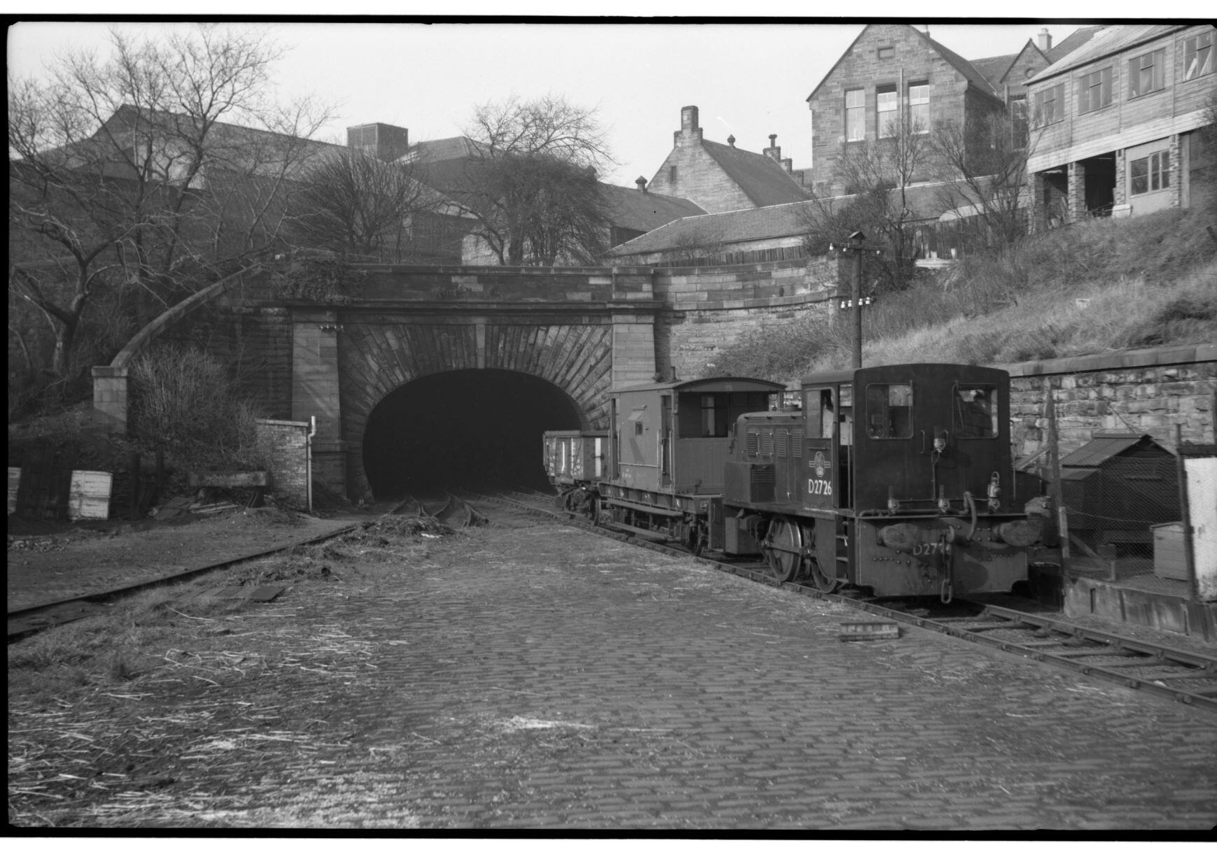
The tunnel itself was 1,052 yards long and climbed at 1 in 27 from Scotland Street to Canal Street; a very steep gradient which necessitated haulage of trains by a continuous cable, powered by a stationary steam engine at Canal Street. In 1862 the line was absorbed into the North British Railway who built a new line to Abbeyhill and Trinity allowing trains from Trinity to be diverted into Edinburgh Waverley (renamed from North Bridge in 1866) from 22nd May 1868. On this date, both Scotland Street and Princes Street closed to passengers. Scotland Street remained in use as a goods and coal depot, accessed only from the north.
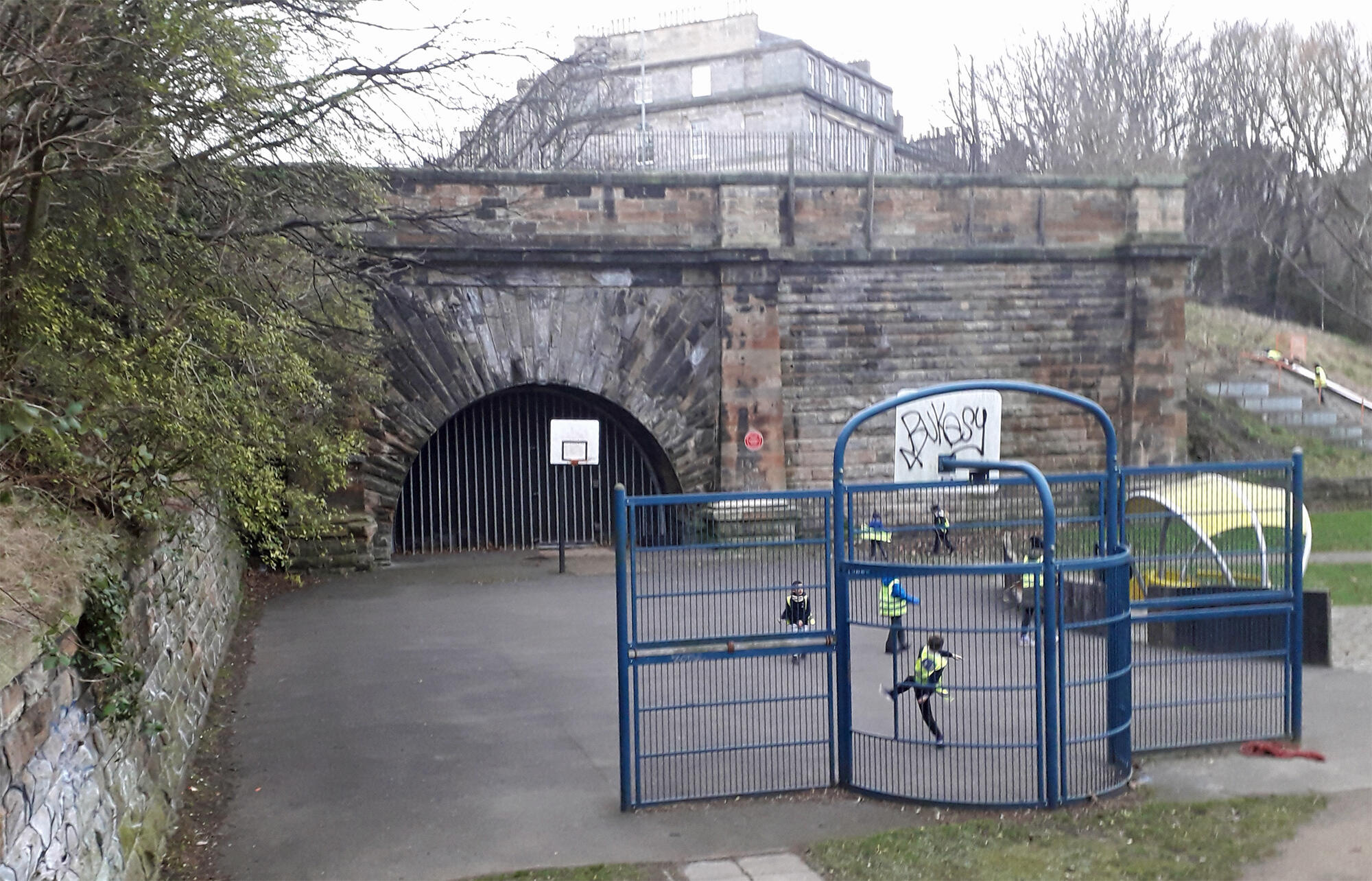
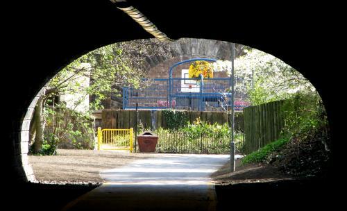
In 1923, the North British Railway became part of the London & North Eastern Railway. The LNER were quick to close loss making lines withdrawing passenger services between Edinburgh Waverley - Granton Harbour on 2nd November 1925 despite local protests. The tunnel was usd by LNER during the Second World War as a hardened emergency control centre. The yard continued to be used as a coal depot until the track was lifted in 1967. The tunnel's final use was for growing mushrooms. Canal Street Station is now lost under Waverley Market. The Scotland Street end of the tunel is now a playground known as Scotland Yard.
A photo in the gallery shows the Waverley end of the tunnel, off Platform 20 - photos from John Yellowlees,
with thanks. Last photo in the gallery (from Stuart Sellar) shows the Bonnington pilot arriving at Scotland Street from the north through Heriothill Tunnel, now a cycleway, in 1960.
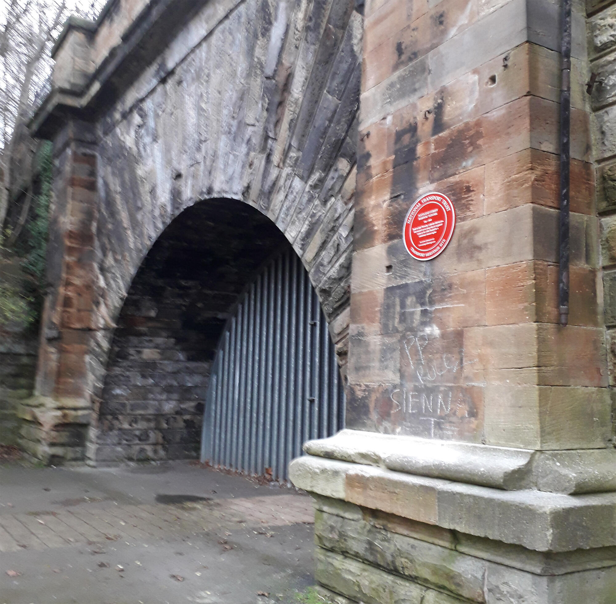
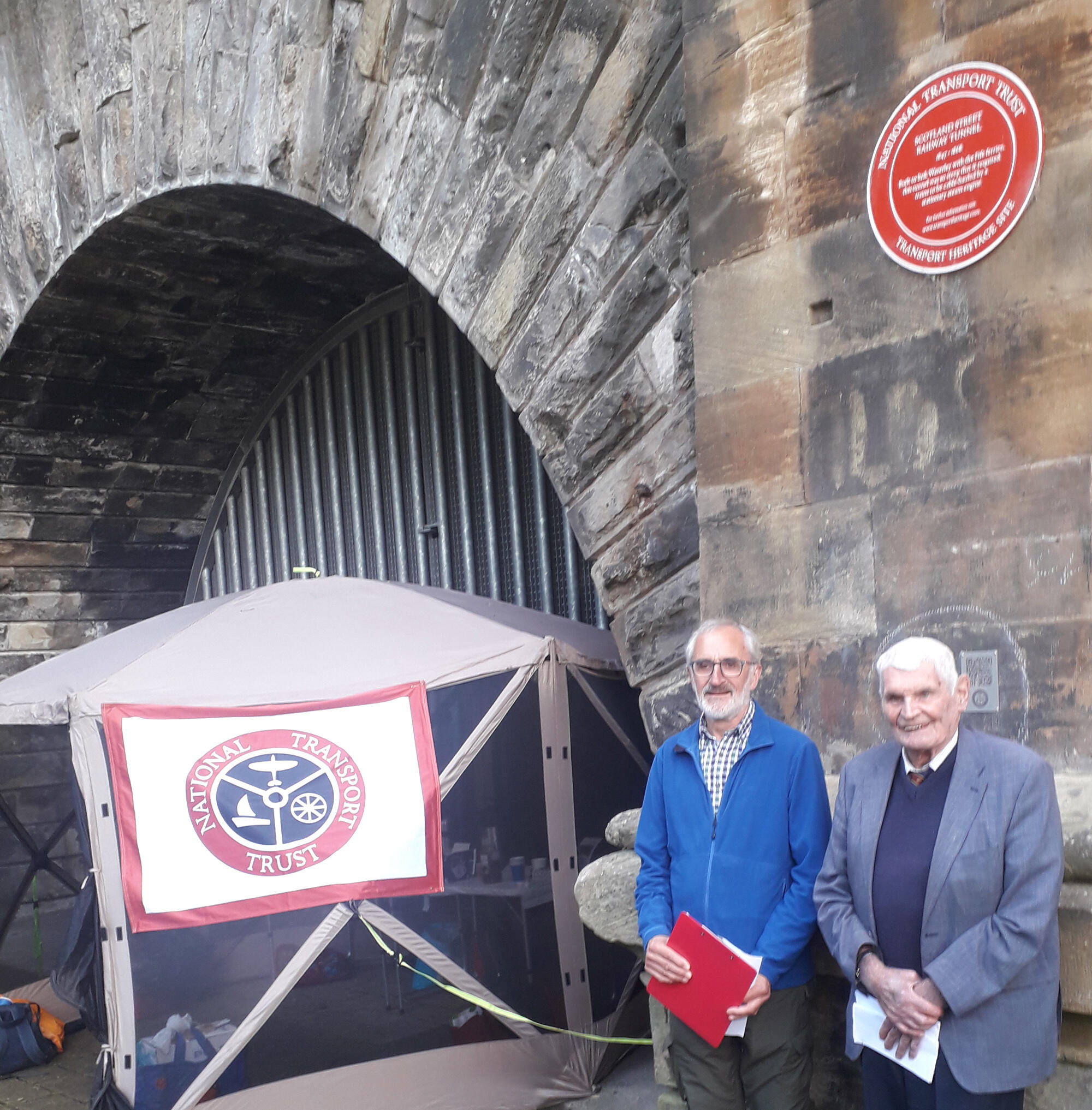
The Red Wheel plaque was erected on 25th January 2022 during Covid pandemic. A formal unveiling ceremony took place on 7th August 2023 where Richard Love, chair of the Broughton History Society and John Cameron CBE , Vice President of National Transport Trust celebrated the occasion. John Cameron remarked:
"For a railway that was open for only twenty years, Scotland Street Tunnel commands a remarkable hold on people's subconscious awareness of Edinburgh's transport heritage. Robert Louis Stevenson recalled that the “sight of the train shooting out of its dark maw with the two guards upon the brake, the thought of its length and the many ponderous edifices and thoroughfares above, were certainly things of paramount impressiveness to a young mind.” The Edinburgh Metro proposal of the 1980s envisaged its reuse regardless of the steep gradient that had been its undoing, and Alexander McCall Smith gave us the false memory of the Edinburgh Underground, triggering surprise among several experts unmindful that its publication date in The Scotsman was 1 April 2011. For myself I rather like the setting's transformation to a children's playground, rejoicing in the name of Scotland Yard and echoing the location in King George V Park of a short-lived Victorian pleasure-ground."
The following article appears by courtesy of the Retired Railway Officers Association (Scotland):
Scotland Street Tunnel by Nick Catford
We are grateful to Subterranea Britannica for permission to reproduce large parts of his article for their magazine in 2006.
On 13th August 1836 the Edinburgh Leith and Newhaven Railway Act received Royal Assent allowing a line to be built from Canal Street in the centre of Edinburgh to Trinity, on the Firth of Forth. Its construction was beset by problems and was delayed for several years because of financial difficulties and objections from local residents who did not want a gas-lit tunnel underneath their homes. The railways engineers were Thomas Grainger and John Miller who had previously worked on many of Scotland's early railways. The site of Canal Street Station (NT260740) is now lost under Waverley Market and Waverley Station. The station had curving platforms from the north to the west and a junction was later formed with the new lines running east-west through Waverley station which faced west.
The Edinburgh, Leith and Newhaven Railway Company opened their horse drawn railway on 31st August 1842, providing a direct link from Canonmills, on the north side of the Edinburgh city centre to Newhaven Station near Newhaven harbour, just west of Leith. Canonmills Station was later renamed Scotland Street. In 1847 the line was further extended southwards to allow services to operate right into the heart of the city. This involved driving a substantial tunnel from Canonmills, under Scotland Street, Dublin Street and St Andrew Square to a new terminus at Canal Street immediately to the north of North Bridge (later Waverley) station and at right angles to it. Canal Street was later renamed Princes Street. At the same time locomotives were introduced north of Scotland Street, replacing the horses.
The tunnel measures 1000yds in length, 24ft in width, and 24ft in height with a gradient of 1-in-27 towards the north. The roof of the tunnel is just below street level at Scotland Street, but is 49 feet deep at St. Andrew Street and 37 feet deep under Princes Street. In order to cope with the steep gradient, cable haulage was required, with a stationary winding engine at Canal Street. Passenger carriages proceeding downhill were steadied by brake trucks, while those heading uphill were hauled by an endless rope, which ran under rollers beneath the rails and was powered by the engine at Canal St. Station. A second shorter tunnel on the north side of
Canonmills took the line under Rodney Street and Broughton Road.
Robert Louis Stephenson wrote of the tunnel, "The tunnel to the Scotland Street Station, the sight of the trains shooting out of its dark maw with the two guards upon the brake, the thought of its length and the many ponderous edifices and open thoroughfares above, were certainly things of paramount impressiveness to a young mind. It was a subterranean passage, although of a larger bore than we were accustomed to in Ainsworth's novels and these two words, 'subterranean passage,' were in themselves an irresistible attraction and seemed to bring us nearer in spirit to the heroes we loved and the black rascals we secretly aspired to imitate."
In 1862 the line was absorbed into the North British Railway who built a new line to Abbeyhill and Trinity allowing trains from Trinity to be diverted into Edinburgh Waverley (renamed from North Bridge in 1866) from 22nd May 1868. On this date, both Scotland Street and Princes Street closed to passengers. Scotland Street remained in use as a goods and coal depot, accessed only from the north.
During WVV2 the tunnel was used as an air raid shelter serving parts of Central Edinburgh. The LNER also used the tunnel as its wartime emergency headquarters, building a series of brick and wooden buildings in the northern end. Because of the natural protection afforded by the tunnel, it was eminently suitable to house a protected control centre comprising a traffic office with centralized traffic control. The traffic controller had telephone links to all signal cabins, goods yards and major stations and offices. There are no facilities for remote operation of signals etc., orders being given from office to signal cabins; military liaison staff would also be present. Scotland Street tunnel was one of ten hardened emergency control centres built by the LNER duringWW2.
All the protected control centres were dispersals for normal peacetime traffic offices, i.e. Liverpool Street moved to Shenfield, Kings Cross moved to Knebworth and Edinburgh Waverley moved to the Scotland Street tunnel etc.
After the war, the railway control centre in Scotland Street tunnel was kept on care and maintenance. Some of the WW2 railway controls had their communications refurbished in about 1951/52 and it seems likely that this would have happened at Scotland Street, as it would have been considered a priority site. In the 1950s, the British Railways Board planned a network of new Emergency Control Centres, but only four out of the proposed 30 were built with the rest of the bunkers shelved in 1956. Those built included Burntisland, Brickett Wood, Knebworth and Huyton Junction. The Burntisland Control Centre was under construction in 1956/7, replacing Scotland Street. Although built, it was never fully commissioned and in 1957 work on the whole project was abruptly stopped, and the British Railways Board set up a series of mobile controls instead. The building at Burntisland is a 40' X 120' flat roofed single storey blockhouse; it is still extant and now houses a diving shop.
Scotland Street Yard continued to operate as a coal depot and one track was retained at the north end of for storing railway wagons. The coal depot closed in 1967 and the track was lifted shortly afterwards. In the 1970s the tunnel was used for growing mushrooms, and Cochranes Garages Ltd leased the north end to store vehicles. It was also used as a location for monitoring natural radiation. A number of schemes for using the tunnel have been mooted since the 1970s, including a new emergency centre for Edinburgh City Councils, which was quickly rejected in the early 1980s. In the in the 1990s there was a proposal to site a giant boiler inside the tunnel to generate power for the city centre and in recent years there have been proposals to use the tunnel as an underground car park and to reopen it for a new light railway or buses.
The site of Scotland Street Station (NT254747) goods yard is now a playground, and the platform area has been levelled and made into parkland. The portals of the tunnels at either end of the station can still be very
clearly seen flanking either side of the playground. The impressive stone-built south portal of Scotland Street tunnel is in good condition. It has been bricked up, probably during WW2 with a gate for access; this is
securely locked. There is some evidence of ventilation plant just inside the tunnel portal behind the brickwork.
The tunnel is u-shaped in section initially sandstone lined but then brick lined running at an incline all the way to
Waveriey. There are a number of walls built across the tunnel with a square doorway in the centre, no evidence of wooden doors remains. The middle section of the tunnel is wet with water running down the walls and long straw stalactites hanging from the roof with further calcium carbonate (flowstone) deposits covering the walls and floor caused by actively running water. When the tunnel was visited by members of the Grampian Speleological Group in July 2001, there was about 18" of water just inside the portal but the tunnel was dry when visited by members of Subterranea Britannica in October 2006.
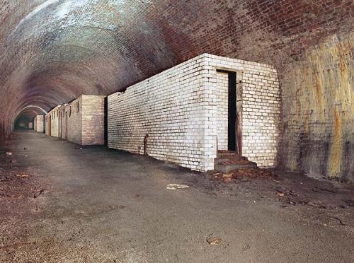
At the southern end of the tunnel, a number of brick buildings survive. The first buildings encountered along the west side are toilet blocks, presumably male and female, which were built when the tunnel was used as an air raid shelter, these include urinals and longs lines of cubicles some still retaining wooden seats with an oval hole under which would have been a chemical toilet (Elsan). On the opposite wall are two wooden signs indicating 'Warden's Post No.10' and 'Warden's Post No.11'.
Beyond the toilet blocks there are a number of larger brick buildings some divided into rooms. These were the offices for the railway control centre. All the buildings have been stripped of any fixtures and fittings, although one room still contains a sink. Beyond the buildings are the bases of a number of wooden huts which have been demolished or have rotted away.
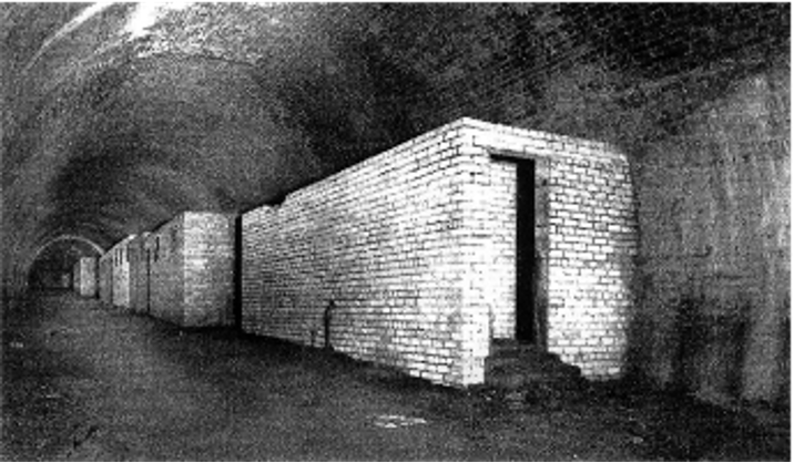
Looking south along the tunnel. The building in the foreground is a toilet block with the LNER emergency control office located in the buildings beyond. © Subterranea Britannica/Nick Catford.
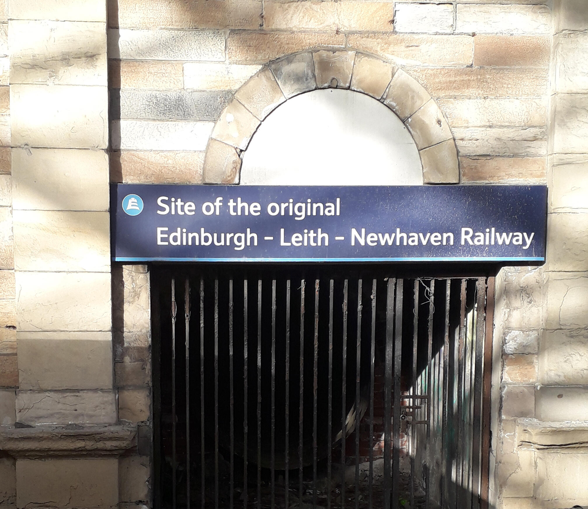
Beyond a staggered blast wall, the tunnel has been blocked. It is unclear if this was at the southern portal or if the southern end of the tunnel was demolished during the construction of the Waverley Market above. Access and ventilation has been maintained through this area along a circular corrugated iron tube underneath Waverley Market. This runs for about 50 yards through a dog leg to a gate in the wall opposite Platform 19 of Waverley Station. Above the gate the inscription 'Site of the original Edinburgh - Leith - Newhaven Railway' can be seen from the platform.
Gerry Fiennes 1967 memoir "I Tried to Run a Railway" mentions Scotland Street Tunnel being used in 1939 to store gas masks, capes, steel helmets and also to provide a refuge for a trainload of expectant mums on the day that World War Two was declared in September 1939. Click here to download that extract

By Road: The north end of the tunnel is in a playground off Scotland Street. The tunnel has been opened as part of a cycle track. It is described in Alexander McCall Smith's novel '44 Scotland Street'.
Biddle, Gordon and Simmons, J., The Oxford Companion to British Railway History, Oxford, ISBN 0 19 211697 5 (1997)
Bonavia, Michael, Historic Railway Sites in Britain, Hale, ISBN 0 7090 3156 4 (1987)
Conolly, W. Philip, British Railways Pre-Grouping Atlas And Gazetteer, Ian Allan Publishing, ISBN 0-7110-0320-3 (1958/97)
Fiennes, Gerry, I tried to Run a Railway, Chapter 3 - extract
Jowett, Alan, Jowett's Railway Atlas of Great Britain and Ireland, Patrick Stephens Ltd. ISBN 1-8526-0086-1. (March 1989)
Morgan, Bryan, Railways: Civil Engineering, Arrow, ISBN 0 09 908180 6 (1973)
Morgan, Bryan, Railway Relics, Ian Allan, ISBN 0 7110 0092 1 (1969)
Ransom, P.J.R., Iron Road: The Railway in Scotland, Birlinn, ISBN 1 84158 728 1 (2007)
Simmons, J., The Railways of Britain, Macmillan, ISBN 0 333 40766 0 (1961-86)
Simmons, J., The Victorian Railway, Thames & Hudson, ISBN 0 500 25110X (1991)
Thomas, J., Regional History of the Railways of Britain, Lowlands and Borders. David & Charles. ISBN 0-9465537-12-7 (1984)
Railscot - Images of Edinburgh Leith and Newhaven Railway
Subterranea Britannica - Scotland Street Tunnel
Summary of a talk given at CILT meeting 27 April 2010
The oddball venture that saw abandoned Edinburgh tunnel filled with mushrooms