Watford Locks

Region:
Red Wheel Site:
Transport Mode(s):
Address:
Postcode:
Visitor Centre:
Website:
Visit website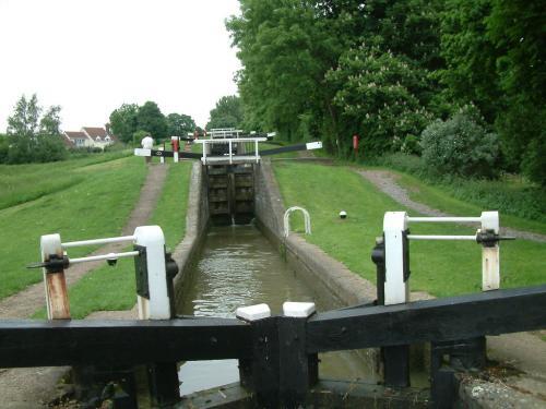
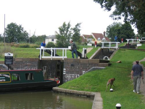
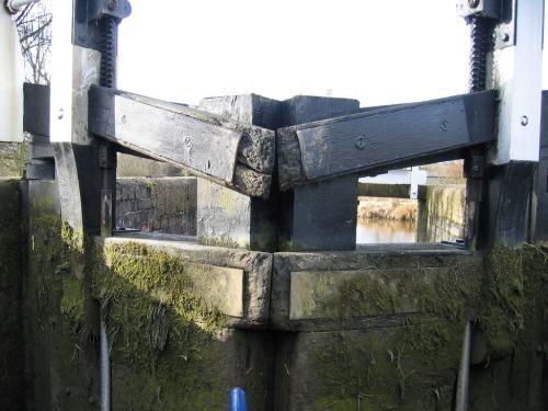
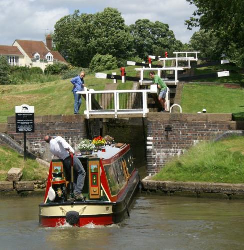
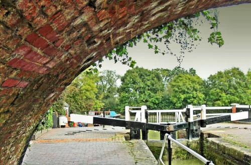
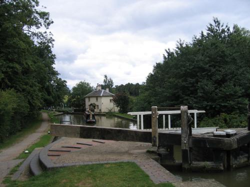
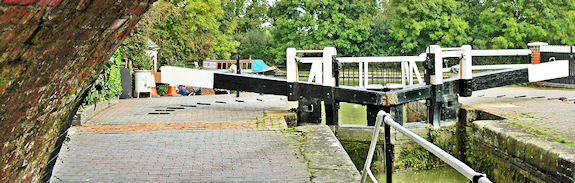
Formed by amalgamations of once-independent canals, the 'Leicester Line' of the Grand Union Canal runs north from Norton junction for about 35 miles (56 km) until it reaches Leicester, where it joins the River Soar to provide a link to the River Trent and to the Trent & Mersey Canal. Watford Locks is a group of seven locks formed (looking from the south), of two single locks, a staircase of four, and a final single lock. Together they lift the canal 16 m (52 ft 6 in) to the "Leicester Summit", which it maintains all the way to Foxton Locks (see entry).
The locks were built to carry narrowboats, and the system was opened in 1814. In the early 20th century there were plans to build an inclined plane similar to that at Foxton as part of a scheme to allow the passage of barges, but the plan was abandoned when the inclined plane at Foxton proved uneconomic.
When the Grand Union Canal was formed in 1929, there were further proposals to widen the flight as part of the modernisation going on elsewhere on the Grand Union's network, but these plans did not develop further.
The locks are hemmed in by the Roman Watling Street (now the A5 road), the M1 motorway, and the West Coast Main Line railway, which all fit through the narrow Watford Gap, between two hill systems. They are usually manned during the summer to prevent water shortages in the ponds between the locks. The keeper also ensures the locks run smoothly and quickly. It should take approximately 45 minutes to complete this flight; it is made quicker by the fact that the locks are single beam and the gates are light.
By road: Off A5, Watling Street. Access is difficult and not suitable for wheelchairs or prams. Going northbound, parking can be found on a hard standing outside a large Caravan sales-shop situated on public land, between two turnings that are signposted as going to Watford. Upon arriving, the locks can be found by walking across a frontage following signposts for the Jurassic Way footpath. The locks can be reached by crossing over a stile.
Atterbury, Paul, English Rivers and Canals, Weidenfeld & Nicolson, ISBN. 0 297 78318 1 (1984)
Bartholomew, Nicholson Inland Waterways Map of Great Britain, ISBN 978-00072 11173 (2006)
Boughey, Joseph, Hadfield’s British Canals: The Inland Waterways of Britain and Ireland, David & Charles, ISBN 978 18401 50247 (1998)
Boughey, J. and Hadfield, C., British Canals: A Standard History, David & Charles, ISBN 978-07524 46677 (2008)
Burton, A., The Waterways of Britain, Collins, ISBN 0 00 218047 2 (1983)
Gladwin, D.D., A Pictorial History of Canals, Batsford, ISBN 0 7134 0554 6 (1977)
Pratt, D., Waterways Past and Present: A Unique Record of Britain’s Waterways Heritage, Adlarde Coles, ISBN 978-07136 76341 (2006)
Pratt, F., Canal Architecture in Britain, British Waterways, ISBN 978- 09032 18139 (1976)
Roberts, B., Britain’s Waterways: A Unique Insight, GEOprojects, ISBN 978- 08635 11158 (2006)
Rolt, L. T. C., Inland Waterways of England, Allen & Unwin, ISBN-10: 0043860060 (1979)
Ware, M.E., Britain’s Lost Commercial Waterways, Landmark, ISBN 978-18430 61816 (2005)