
Lambley Viaduct

Outstanding tall and elegant structure crossing the South Tyne
Region:
Red Wheel Site:
Transport Mode(s):
Address:
Lambley, Northumberland
Postcode:
Visitor Centre:
Website:
Visit website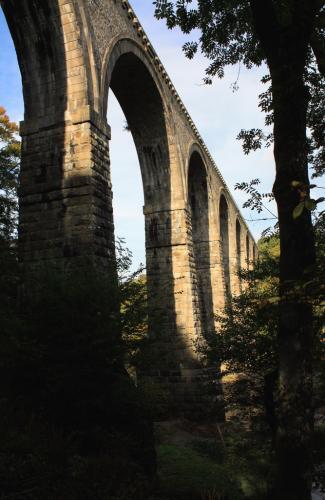


The Newcastle and Carlisle Railway, 97 km (60 miles) long, was built in the 1830s and links the city of Newcastle upon Tyne in Tyne and Wear with Carlisle in Cumbria. The formal opening took place on 18 June 1838.
The first suggestion, made by Ralph Dodd at a meeting in Newcastle on 1st November 1794, was for a broad canal to Hexham on the south bank of the Tyne, as the first section of "An Inland Navigation from the East to the West Sea". In the following year, William Chapman surveyed an alternative route high above the north side of the river, and there then followed two years of controversy between the different routes. Nevertheless, in 1797 a Bill based on Chapman's plans reached the Committee stage in the House of Commons before being withdrawn due to the strength of the opposition.
The Napoleonic Wars delayed further progress from Newcastle, and the people of Carlisle decided to build a short canal connecting their city with the Solway Firth, which opened on 12th March 1823. In the following year, Chapman was asked to Report on the cost and separate advantages of a Ship Canal and of a Railway from ˜Newcastle to Carlisle', and he estimated that even a minimal ship canal would cost at least three times as much as a railway which could carry the same traffic. Josias Jessop confirmed the overall advantages of a railway in a report dated 4th March 1825, and a prospectus for the Newcastle & Carlisle Railway was issued only 24 days later, followed by a meeting of shareholders in Newcastle on 9th April. After various delays, notice of application for the Newcastle & Carlisle Railway Bill was made on 4th November 1828 and, after a stormy passage through the House of Commons, it received the Royal Assent on 22nd May 1829. The pioneering nature of the N.&.C.R. can be realised when it is remembered that the Rainhill Trials had not yet taken place, and its 101 km (63 miles) made it the longest railway authorised at that date.
With their main line completed and prospering, the N.&.C.R. directors decided to apply to parliament for powers to build branches up the valleys of both the North and South Tyne Rivers, but the Act of 26th August 1846 only authorised a line from Haltwhistle to Nenthead. No work was done until a second Act was obtained which allowed the heavily graded extension from Alston to Nenthead to be abandoned. Construction then proceeded rapidly and the line was brought into use in sections from 1851, with the entire branch being opened on 17th November 1852. The Alston branch was the final extension of the Newcastle & Carlisle Railway, as, after two unsuccessful attempts, on 17th July 1862 an Act was, obtained to authorise amalgamation with the North Eastern Railway.
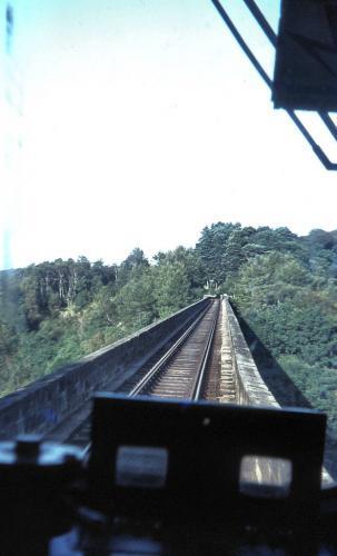
The Alston branch covered 27 km (17 miles) from the town of Haltwhistle. This branch provided passenger services and also, in the early days, served the hundreds of lead mines in the upper South Tyne Valley. It included the monumental Lambley Viaduct and was the last of the branch lines to close in 1976. Part of the Alston end has been turned into a narrow gauge heritage railway, the South Tynedale Railway. The railway company's intention was to carry the lead, coal and other minerals in the Alston district. Rival schemes were proposed but it was the Newcastle & Carlisle railway whose scheme obtained Parliamentary approval. Passengers were of secondary importance at first but eventually, with the decline of first lead mining and then coal, the line retained some importance as a vital link in the often severe winters in the district. When a so-called 'all-weather road' was opened in 1976 the line closed.
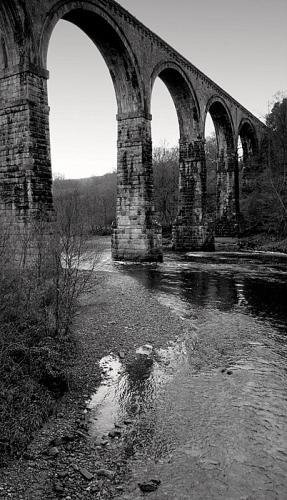
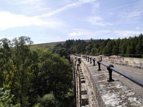
Lambley Viaduct spans a steep sided wooded valley and excellent views can be had from the top. In 1996 the viaduct was restored and is approached from Lambley village via a footpath leading downhill to the river where the pillars can be explored at river level.
The viaduct may have been designed by George Barclay Bruce, an eminent Victorian engineer who was involved in the Alston line before leaving for India to pioneer railway construction there. It is a particularly elegant example of Victorian engineering: the river is crossed by nine 17m (56 ft) wide arches which support a deck 32m (105 ft) above the river but, as it carried a single rail track, only 3.5m (11.5 ft) wide.
The piers to the arches are built of massive rough-faced stones each weighing up to 500kg, with similar-sized stones in ashlar to the main arch voussoirs. The spandrels and piers to the 6m wide (19.7 ft) approach arches are built of coursed rubble masonry. This elegant structure was acquired from the BR Property Board by the North Pennine Heritage Trust in 1996. the trust went into administration in 2011.
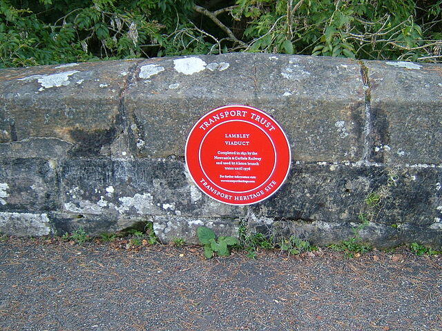
By road: On A689. A footpath leads from the village. The top of the viaduct is reached by climbing a stairway built onto the viaduct's side. A plaque with some details of its building is at the southern end, while at the other end a board provides information about the railway and its surroundings.

Biddle, Gordon, Britain's Historic Railway Buildings, Oxford University Press, ISBN-10: 0198662475 (2003)
Biddle, Gordon & Nock, O.S., The Railway Heritage of Britain : 150 years of railway architecture and engineering, Studio Editions, ISBN-10: 1851705953 (1990)
Biddle, Gordon and Simmons, J. The Oxford Companion to British Railway History, ISBN 0 19 211697 5 (1997)
Conolly, W. Philip, British Railways Pre-Grouping Atlas And Gazetteer, Ian Allan Publishing, ISBN 0-7110-0320-3 (1958/97)
Fawcett, Bill, A History of the Newcastle and Carlisle Railway 1824-1870: The First Line Across Britain, North Eastern Railway Association, ISBN 978 18735 13699. (2008)
Smith, Martin, British Railway Bridges and Viaducts, Ian Allan, ISBN 0 7110 2273 9 (1994)
Rennison, Robert William, Civil Engineering Heritage, Northern England, Thomas Telford, ISBN-10: 0727703579 (1986)
Whittle, G., Newcastle and Carlisle Railway, David & Charles, ISBN 978 07153 78557 (1979)
Bridges on The Tyne - Lambley Viaduct
Derelict Places - Lambley Viaduct
Forgotten Relics - Listed Bridges and Viaducts